Published
Still whitecaps
Why do whitecaps seem almost still when you’re 1000 feet in the air looking down at the ocean?
Published
Why do whitecaps seem almost still when you’re 1000 feet in the air looking down at the ocean?
Published
Published
Couldn’t care less about going to bed covered in salt as a kid, now I have to wash it off.
B was nuts about the waves.
Published
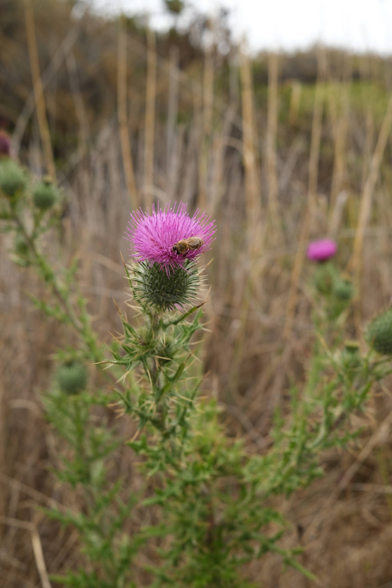
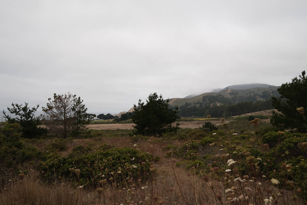
We took B on his first walk on August 20th, in the hills above Montara beach. It was his first time in the carrier, we thought he’d resist but he loved it. The hills are a lot drier than the last time we walked through here, but there were thistles and nasturtiums out. We saw a coyote on our way back down.
We took him to see the sea too. Thought about dipping his toes in the water, but the beach was too steep and the waves too high. Another time.
Published
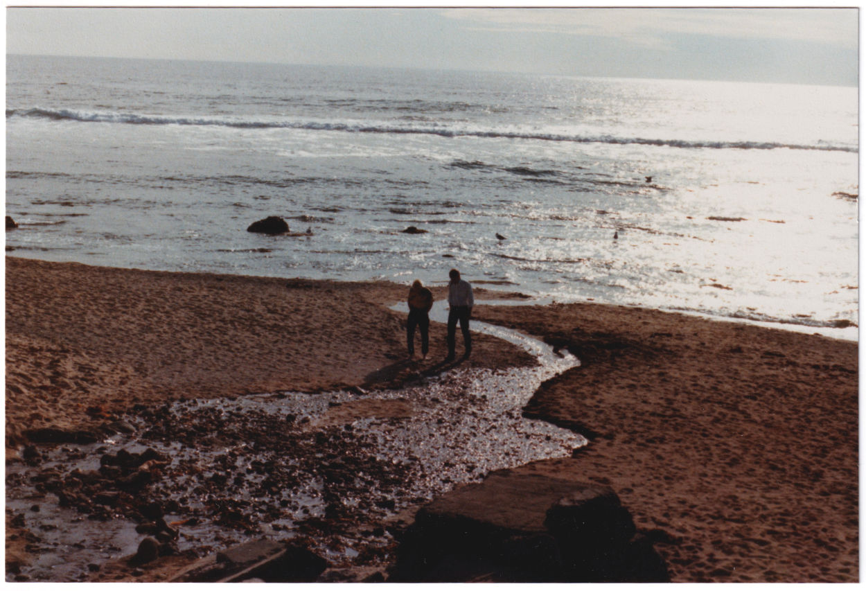
Rat Beach in 2010
I came across the article below recently and was pretty floored.
I grew up in Torrance till I was 5 and Palos Verdes until I was 13. I played in the ocean at Rat Beach all the time, caught tadpoles in the storm drain just next to PVBAC, went tidepooling in Abalone Cove. I had no idea about the Superfund site, this is the very first time I’ve heard of it. How on earth is that?
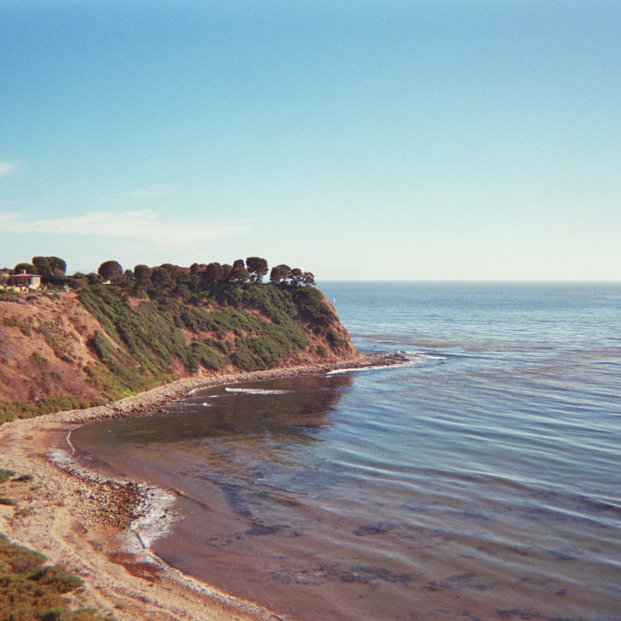
Lunada bay in 2010
It looks like the Superfund site starts just south of Lunada Bay and gets worse as you pass Portuguese Bend down towards San Pedro (see map).
And now they’ve verified punctured DDT waste barrels that have been sitting on the sea floor just off Catalina, possibly since the 1980s. This could be three to four decades of leakage from up to half a million barrels.
They leaned in to examine an icicle-like anomaly growing off one of the barrels — a “toxicle,” they called it — and wondered about the gas that bubbled out when the robot snapped one off. To have gas supersaturated in and around these barrels so deep underwater, where the pressure was 90 times greater than above ground, was unsettling. They couldn’t help but feel like they were poking at a giant Coke can ready to explode.
Sea lions up and down the coast have been dying from it for decades, and still are. We eat a lot of seafood from these waters.
How can this possibly be cleaned up, and who on earth is going to pay for it? Certainly not the Montrose Chemical Corp. of California, they’ve been gone for years.
It’s just so exhausting. It feels like so many people’s jobs right this moment are simply running around slapping Bandaids left right and center, scrambling to fix what have become systemic problems caused by the poor decision making of people in the past. Lack of foresight, deliberately turning a blind eye, “we’ll deal with it later”, “it can’t possibly be that bad”. The environment, tech, policing, advertising.
So much firefighting.
Published
Published
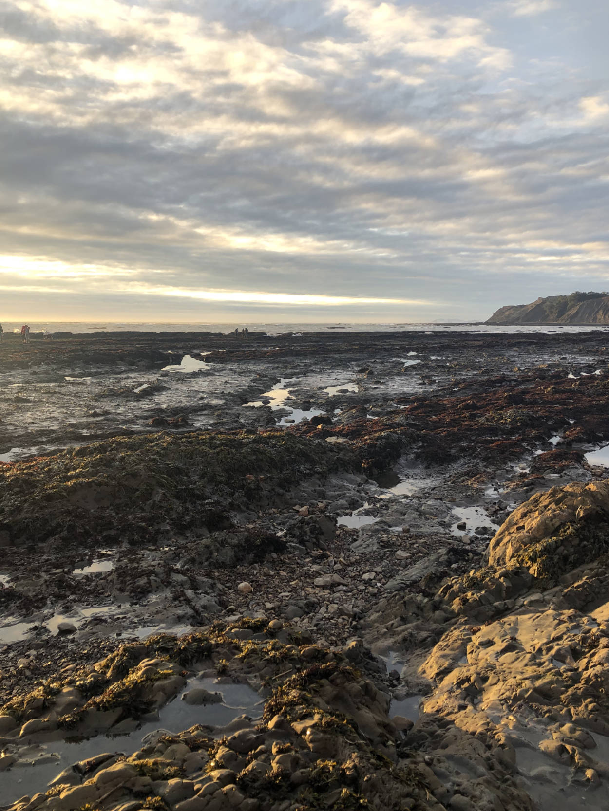
Haven’t been feeling great recently so a lot of weekends have been pretty quiet, but we finally got out a bit this past Saturday. Went to Agate Beach near Bolinas, low tide was around 3:30pm so we had lovely light. It had rained hard earlier so we kept hearing mini rockslides from the cliffs. A little ominous.
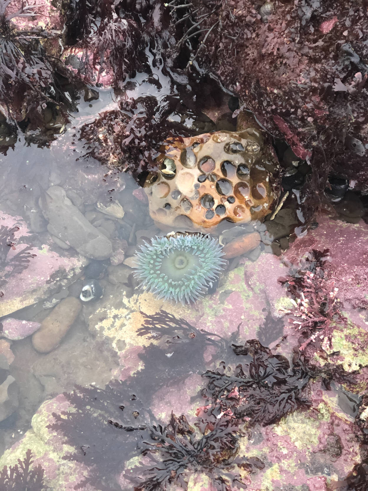
It was hard to see much since most of the pools were a bit murky, but we did see chiton, anemones, snails, crabs, and one hefty brown starfish. There was pink coralline algae encrusting most of the rock pools. I didn’t know what it was when we were there, thought it was so prevalent that it might be invasive. But it seems native from what I’ve read since. There was also one tiny creature that squirted water a foot in to the air, still no idea what that was…
Related: One of the rental properties at Sea Ranch has some really good tips about being a good tide pool steward.
Also related: Didn’t collect anything since foraging isn’t permitted on most public land in California. I’d love to get to Salt Point at some point though since it’s allowed there. Would probably mainly look for purple laver and nori. Samphire (pickleweed) should be prevalent in April/May, so maybe that would be a good time to go. Also hopefully this pandemic will be on the wane by then with the vaccine…
Published
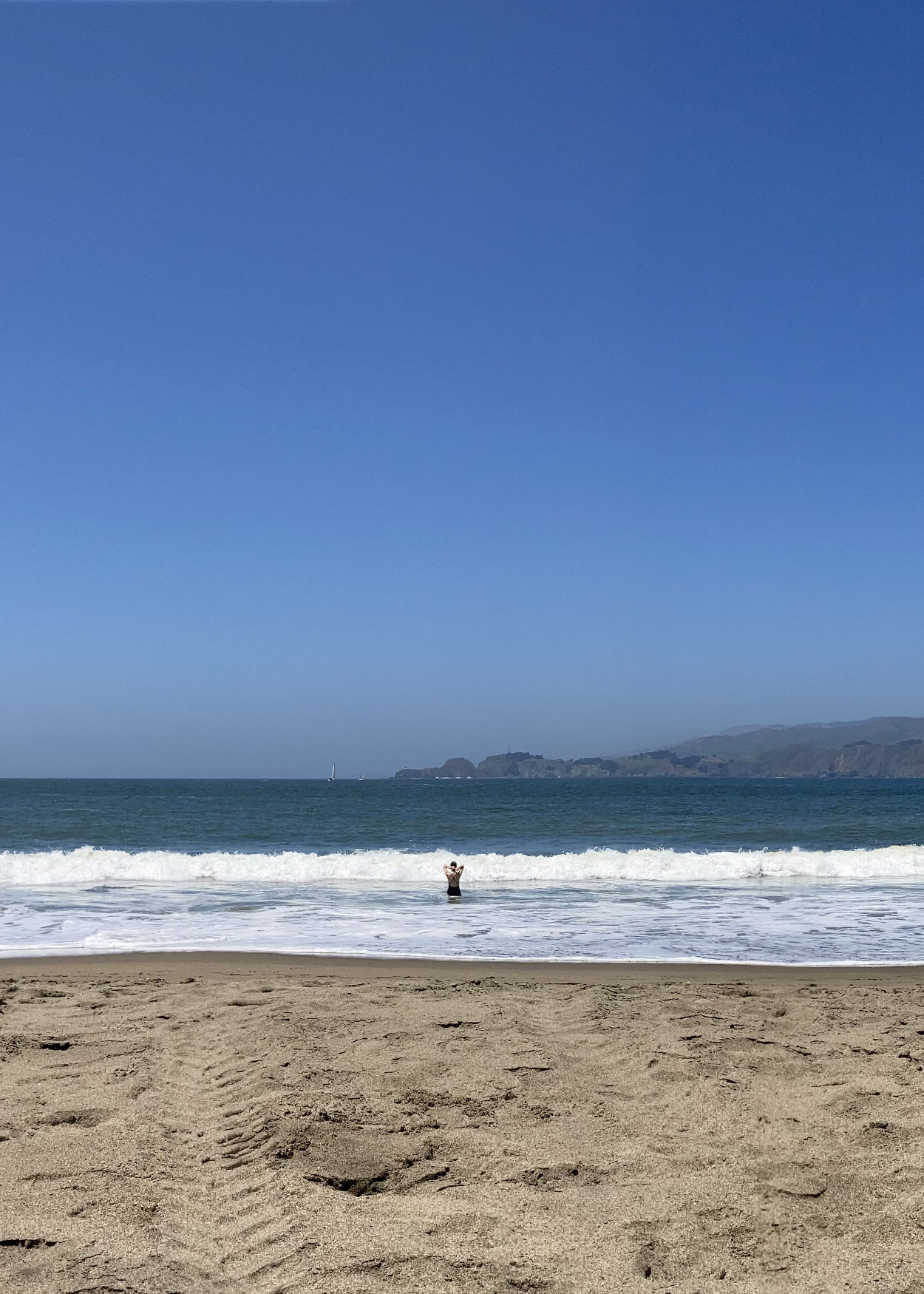
My first swim in the Pacific in probably 10–15 years, photo by Sam.
On the Fourth of July, we walked 10 miles from the Sutro Heights Stairs on Balboa Street through Land’s End, past the enormous houses near China Beach, paused at Baker Beach, dipped down to Marshall’s Beach, walked under the Golden Gate, along Crissy Field and through the park at Fort Mason, then took a rest at the Maritime Museum ampitheater before heading back.
I thought I did so well with sunscreen but oh my, the backs of my knees…
Published
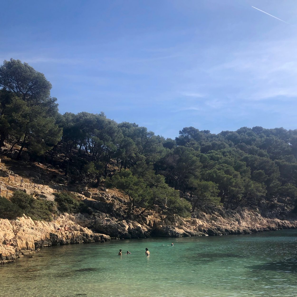
Spent a few days in Ceyreste (FR) recently with new and old friends to celebrate our dearest GC’s 30th. Lots of good food, time in the sun, swimming, etc, just what the doctor ordered. These are a few things I’d like to remember.
Calanques national park is beautiful. It can also involve some serious walking. I’m glad we brought a proper map, glad that we’d brought enough water between us, glad that we’d just missed peak tourist season, and really glad that GC bought some snacks!
We drove to Cassis and parked as close as we could to Calanque de Port Miou towards the west end of the town. This ended up being the metered parking on the corner where Avenue Révérend Père Jayne turns into Avenue des Calanques, the rest of the way down to Calanque de Port Miou was marked “sauf riverains” or residents entry only. After that we walked down Avenue des Calanques till we hit Port Miou, then we walked southwest on the main gravel path marked white/green/red running parallel to the calanque. We paused where the white path looped north and the green/red path continued southwest, and that’s where LM and DP peeled off with the littlest one in the buggy to head back in to town along a reasonably flat path.
The rest of us continued on the green/red path to Calanque de Port Pin which was slightly rougher going. The rocks got particularly slippery right before the beach. We paused at Port Pin for a swim and to wait for some later arrivals to join us. The water was beautiful, and chilly! It was sunny, but the heavy wind probably contributed to the chill.
After Calanque de Port Pin, KB, SC, and their little one headed back to Port Miou on the white path heading north. The rest of us headed uphill on the green/red/blue path just as some dude with a carbon fibre alphorn showed up… The going was slightly rough but not too bad. The top of the hill was a sort of crossroads with another path running flat along the ridge. It marked the beginning of our descent towards Calanque d’en Vau.
The sign at the crossroads indicated tough terrain, and the path was marked with “danger dots” 🔴🔴🔴🔴🔴🔴 on the map. It was rough, incredibly steep and involved a lot of shuffling around on your butt. It was also super windy. We eventually reached the bottom unbroken and joined a reasonably flat white path leading the rest of the way to Calanque d’en Vau. A 4×4 ambulance blasted past us on this stretch, apparently some hikers had tried to go up the steep cliffside of the calanque and got in to a sticky situation. Unfortunately we got to the beach too late in the day for any sun, but we took a chilly swim anyway. Tons of fish! I’d love to come back to go snorkelling, I’d probably take a different path in though or at least wear much sturdier shoes.
To get back to where we had parked, we had to head back up the danger dots path. It was daunting but way easier going up. We then took a left at the crossroads to head north on the level white/blue path. When we hit what I think was a church, we took a right on a descending white path heading east which merged with the brown/yellow path about halfway down. Eventually Port Miou came in to view, and then the path switchbacked down to where we started.
Learned about a few new cocktails from the masters themselves. Boulevardier = 1 oz bourbon + 1 oz Campari + 1 oz sweet vermouth w/ orange peel to garnish (basically a Negroni w/ bourbon instead of gin). Paper Plane = ¾ oz bourbon + ¾ oz amaro + ¾ oz Aperol + ¾ oz fresh lemon juice. No amaro to be found at the hypermarchet sadly, but they still gave it the old college try and it was pretty tasty.
The ultimate moderator also led us in Werewolf, a game that was new to me. We played a simplified version w/ just a werewolf and a doctor which was perfect for a big group of beginners. It’s pretty similar to Mafia w/o cards.
The plants and landscape in Provence reminded me so much of southern California, and the dry stone walls along many of the smaller roads reminded me of Yorkshire.
There was wild rocket along all the highways just outside of Marseille, but unfortunately not where we were staying. There were a bunch of strawberry trees around the house and a lot of thyme and rosemary which was super useful for cooking. In retrospect I think there might have been savory as well, but I’m not totally sure what that looks or tastes like.
Not sure if I encountered many mosquitos outside but we definitely had 2–3 trapped in our room. I have some gnarly bug bites.
There was so much good food. Definitely glad I remembered lactase pills because it would have been super sad to miss out on the cheese and NB’s excellent carrot cake. Will definitely be referring back to that recipe, particularly since it works well with GF flour as well. And pizza! The place had a pizza oven which was excellent, particularly since the two Italians in the group were kind enough to lend their brains to the operation. Dinner on the last night was a use-up-all-the-things meal, see recipes / descriptions.
It had been far too long since I’d seen so many of these people.
Published
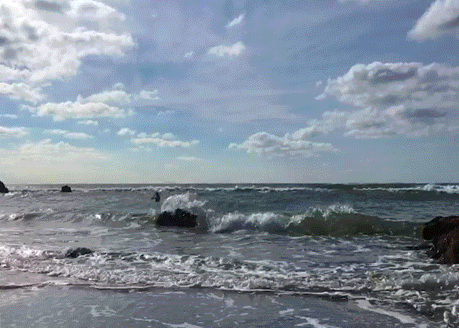
Friday 28 September 2018
Swam in the sea at Abbey River Beach with Ben, Daisy, Joe, Sam. It was ~60F/16C outside, ~62F/17C in the water. Very sunny, warm when the breeze died away. GIF grabbed from video by BL.