Published

On saguaros and an old dirt road

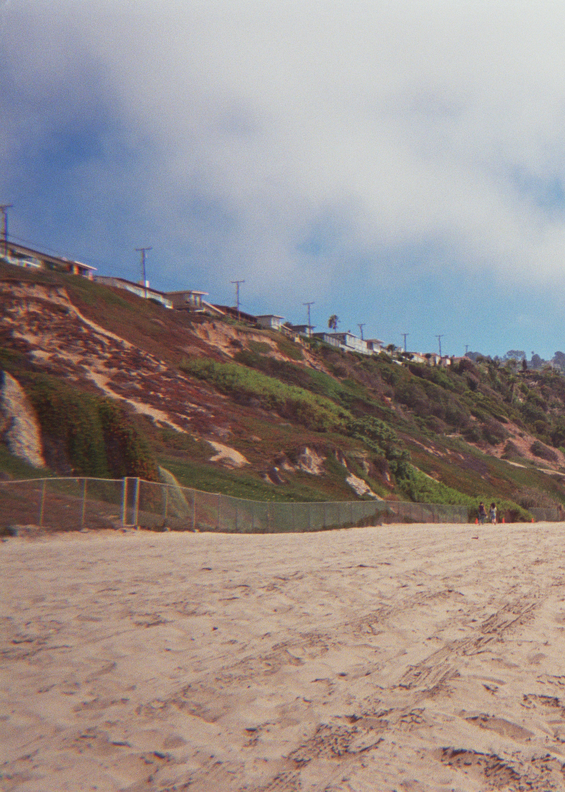
Another plant-related fact I learned from Techentin’s essay in “Edges of the Experiment” (see previous): saguaros are frequently chipped by park rangers to deter plant poaching.

Saguaros only grow in the Sonoran desert, the bulk of which lies in the southwest corner of Arizona and in Mexico. Arizona State Route 88 is near the northeastern edge of the Sonoran desert, so saguaros feature in much of the landscape alongside the road. The AZ SR88 runs from Roosevelt Dam along the Salt River to Apache Junction. It is mainly unpaved between the dam and Tortilla Flat. I had the pleasure of driving this road with my grandparents on my mom’s side a little while back.

Satellite view of Arizona State Route 88, imagery and map data copyright Google 2016

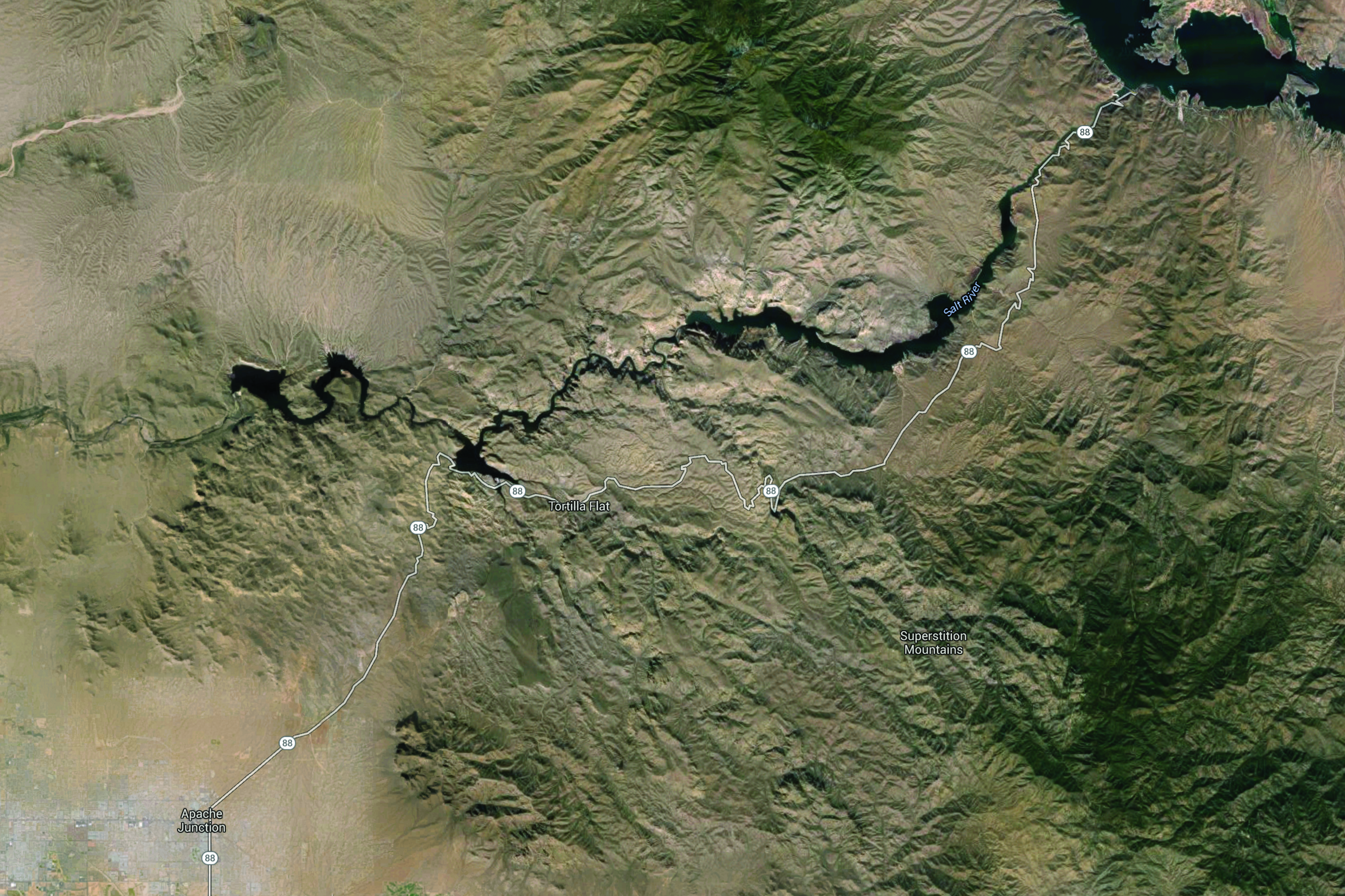
Satellite view of Arizona SR 88. Imagery and map data © 2016 Google.

Satellite view of saguaros along Arizona State Route 88, imagery copyright Google 2016

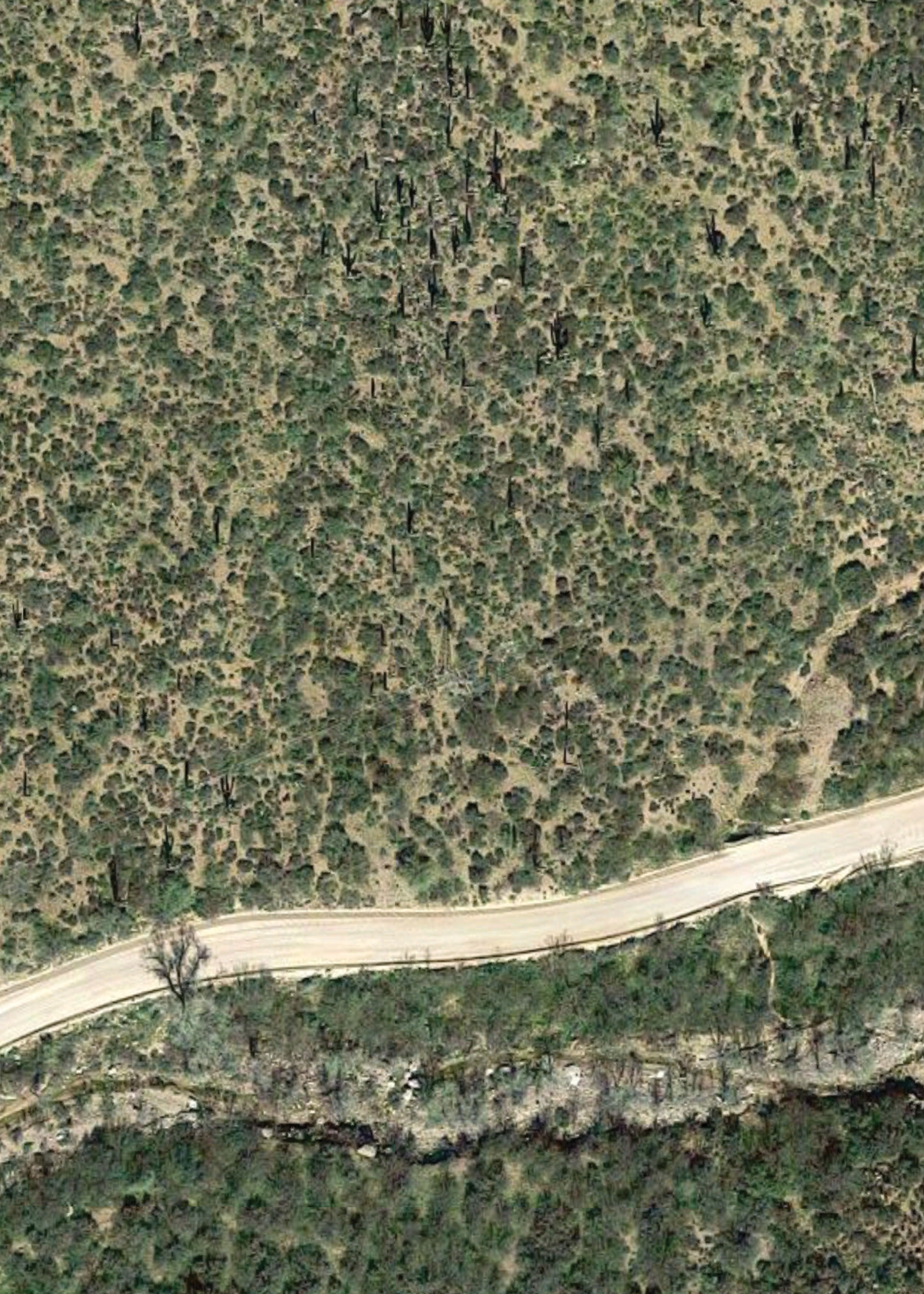
Satellite view of a particularly saguaro-laden hill just east of Fish Creek grade along Arizona SR 88. Imagery © 2016 Google.

One notably narrow section of the road is about halfway through the unpaved portion of AZ SR88. A steep grade culminates in a sharp blind turn that wraps around Fish Creek Hill, with a sandy wall on one side and a steep dropoff on the other.

For the most part, the narrowness of the road isn’t a problem. Drivers don’t use it to get anywhere quickly, so it’s a lonely route.

Most of the traffic flows east with good reason. If you drive west on this route late in the day, you end up driving straight in to the sun. You also end up driving on the outer edge of the sharp turn mentioned above, and it’s a little nerve wracking looking down the long drop just beyond the low barrier.

That said, the westbound trip on AZ SR88 has a pretty spectacular finale. If you time it properly you’re rewarded with a desert sunset over the Superstition Mountains near Canyon Lake before descending in to Apache Junction.

Published

On palm trees, one in particular

Photo of RAT beach taken by Piper Haywood in 2009

RAT Beach in 2009. RAT = Right After Torrance

When I was very young, I developed a sustained, irrational fear of the palm tree that stood near the southwest corner of Deelane Street and Anza Avenue in Torrance, CA.

This fear is one of my earliest memories. The palm was cartoonish and stereotypical. It was spindly and swayed even on very still days. I lost my four-year-old mind every time we passed it on foot, convinced that it would fall over and pile drive me in to the ground.

The palm tree no longer exists. It was probably removed just after we moved away in 1993.

Satellite view of Deelane Street and Anza Avenue (Torrance, CA) in 1980 and 1994

Satellite view of the corner of Deelane Street and Anza Avenue in Torrance, CA. Left image was captured in 1980, right image was captured in 1994. Source for both images is USGS via historicalaerials.com

I picked up “Edges of the Experiment – The Making of the American Landscape” from the Fw:Books table at Offprint a couple of weekends ago. It is a two-volume publication designed and edited by Hans Gremmen focusing on the landscape of the American West. The first volume features photographs by Marie-José Jongerius and is punctuated with essays. The second is more text-based and includes a curated selection of media; historical photographs, anecdotes, facsimiles, essays, etc. The photos by Jongerius are what originally drew me to the publication. They are incredibly true to the place.

Last weekend I started reading volume two, including an essay titled “The infrastructure of trees in Los Angeles” by architect Warren Techentin. I learned that the palm tree is a disappearing southern Californian icon:

Considering that the average lifespan of a palm tree is 70 to 100 years, and that most of the palms visible now were planted to beautify the city for the 1932 Olympics, the bulk of Los Angeles’s palm trees will disappear within a decade or two.

Warren Techentin, “The Infrastructure of Trees in Los Angeles”, Edges of the Experiment: The Making of the American Landscape, Vol. 2, Netherlands: FW:Books [2015], p74.

The city isn’t replacing most palms that are removed. Apparently they were never a great ecological or economical choice.

So my childhood nemesis was likely removed due to old age. It’s kind of sad. I haven’t found any photos of that particular palm tree.

I can’t emphasise enough how much I have enjoyed “Edges of the Experiment”. One particularly lovely spread includes the first page of Techentin’s essay alongside one of Hans Gremmen’s graphics illustrating water usage in California. Water is touched upon in many if not most of the texts in “Edges of the Experiment”, and its presence (or lack thereof) is notable in many of Jongerius’s photos.

Published

Link to an essay about the Guidonian Hand

The Guidonian Hand →

An essay by Karol Berger from The Medieval Craft of Memory: An Anthology of Texts and Pictures. Relevant to an upcoming Musarc performance conceived by Hefin Jones for an Up Projects event.

– – –

Edit 20 May 2016 — Photo from last night ↓

Photo taken by Laura M A Harford of Musarc performing a Hefin Jones piece for Up Projects

– – –

Edit 24 May 2016 — Even more photos on upprojects.com

Published

Graph paper used by Chana Horwitz

Chana Horwitz seems to have frequently used Keuffel & Esser Co. 8 × 8 to the inch graph paper. There were a few pieces in the Raven Row exhibition on 10 × 15 inch sheets with an orange grid. It looks like K&E was acquired in ‘87, wonder if she stockpiled a bunch of it. Also, food for thought: how do you mount+frame mylar in such a pristine way without any show-through?

Published

Video tutorial on P5 and Prim’s Algorithm by Daniel Shiffman

I’ve wanted to do this for ages with Distributaries. I tried to find a minimum distance solution that wasn’t OTT back when I started collecting location coordinates, but I probably wasn’t using the right vocabulary in my searches… ended up ordering them manually (!). Would like to get this in place, I think the manual ordering is part of the reason I’ve been tardy in adding more coordinates.

Published

And now the Shipping Forecast

Lows western France 1011 and 100 miles east of Iceland 991 losing their identities

The General Synopsis from the Shipping Forecast issued by the Met Office on behalf of the Maritime and Coastguard Agency at 1100 UTC on 18 February 2016.

Couldn’t find the shipping forecast on the Met Office DataPoint’s product list, but I did find the relevant XML feed.

Published

Notes from 24 Pull Requests event

See notes and further research prompts below in relation to yesterday’s 24 Pull Requests event. It was organised by Codebar, Ladies Who Code, and Your First PR, sponsored by Gitter, Shutl, and Twitter. I left Twitter HQ with my brain fizzing, always a good thing.

Read more